Treaty of Limits
Treaty of Limits was shown at MARGS within the exhibition “Além Fronteiras” of the 8th Mercosul Biennial curated by Aracy Amaral.
.
The Treaty of limits project began with a trip through the pampas region in February 2011. This trip covered the southern region of the state of Rio Grande do Sul and the northern region of Uruguay. Traveling through this region made me think about the geographical and political delimitations between states and countries.
The pampas create their geographic delimitation determined by their specific biome, making border definitions seem meaningless. The continuity of the fields in pampa’s landscape refers to a dilution of borders, to a perception that they are not always perceptible or relevant, and that the region is instead identified through its characteristics and not necessarily through political borders delimitations.
The texts “Tratado de Limites entre o Brasil e a República Oriental do Uruguay” and “Extremo Sul do Brasil (Limites do RS)” gave origin and name to the project. These texts relate the border delimitation process in the southern region of Brazil and Uruguay, between political disputes and geographical specificities.
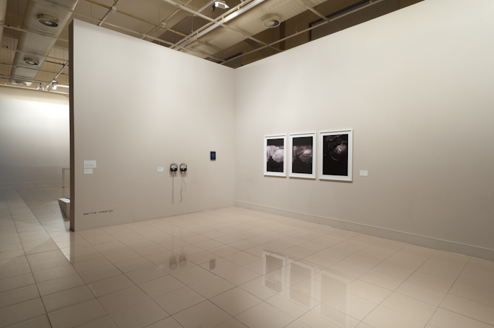
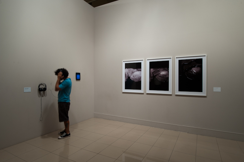
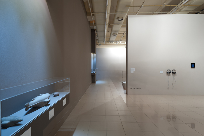
Exhibition pictures by Fabio del Re.
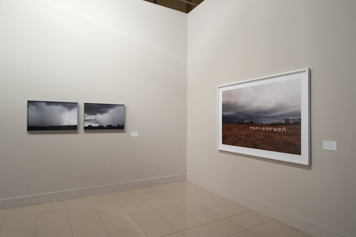
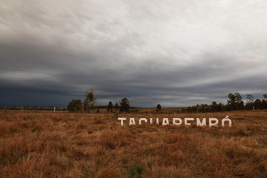
Place: Tacuarembó
Tacuarembó, in Uruguay, is geographically the central region of the pampas. In recent decades, Tacuarembó has been called the capital of the pampas. For Uruguayan, Argentine, and the southern Rio Grande do Sul gauchos; this city is a cultural reference, a convergence of events in the pampas: a capital that brings together three distinct countries, constituting a shared cultural identity.
In the region of Tacuarembó, several indigenous archeological sites have already been mapped but are kept underground for security and preservation reasons.
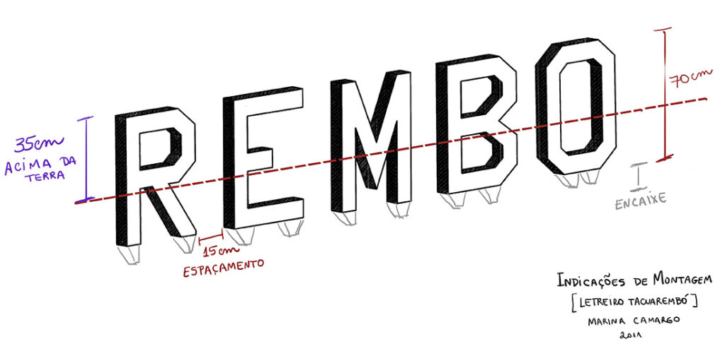
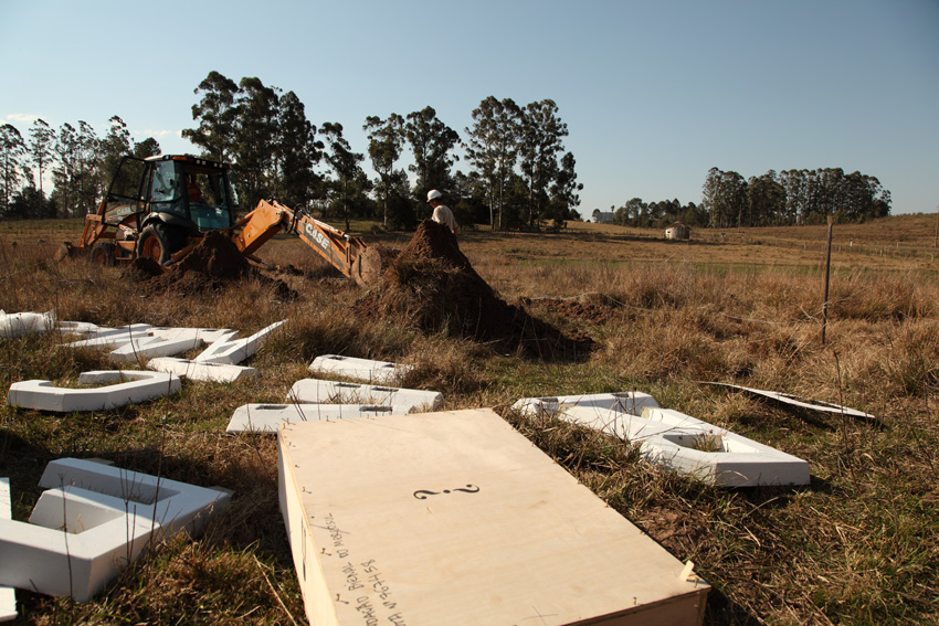
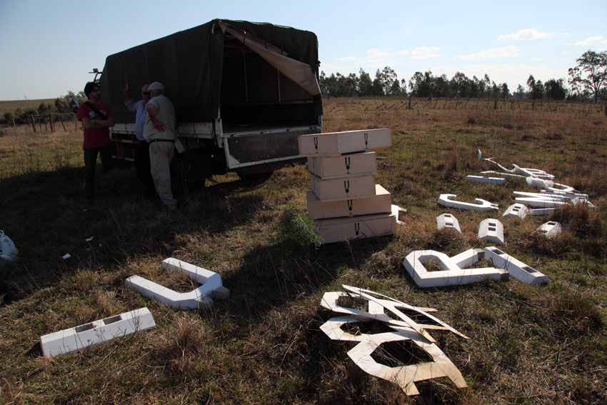
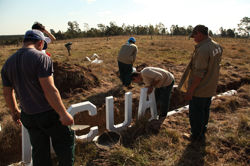
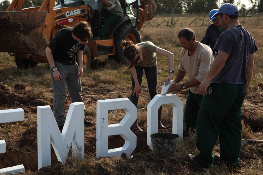
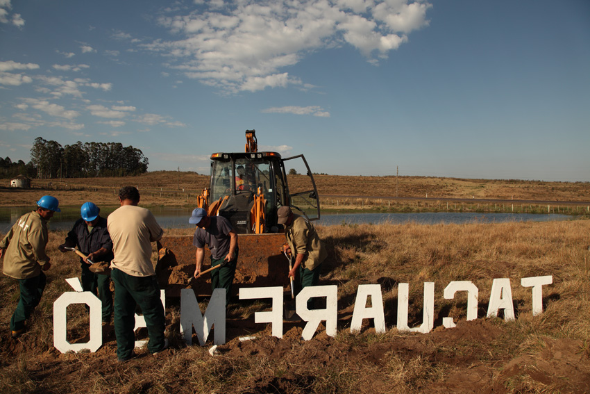
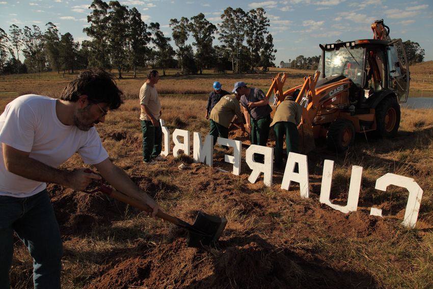
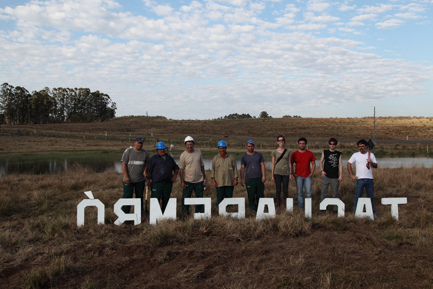
The signs at the entrances of many cities in the interior of Brazil are a reference to “Lugar: Tacuarembó.” Letters made of concrete are usually fixed at the entrance of towns with the city’s name.
The concrete letters that spell “Tacuarembó” were partially buried at the entrance of the town (1/3 of the sign is above ground). In addition to the installation, the photograph “Lugar: Tacuarembó” records the open-air work.
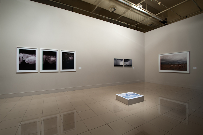
Geography (landscape with waves)
“Landscape with waves” is the sound work made from the proposal to create a sound landscape from graphics that draw undulations at angles from 30º to 40º (the pampas region is between the latitudes of 30º and 40º).
“Landscape with waves” is made from simulations of wind sound mixed with harmonica and guitar tones (from the song “Negro da Gaita” by César Passarinho) and sound manipulations performed by musician Leonardo Boff.
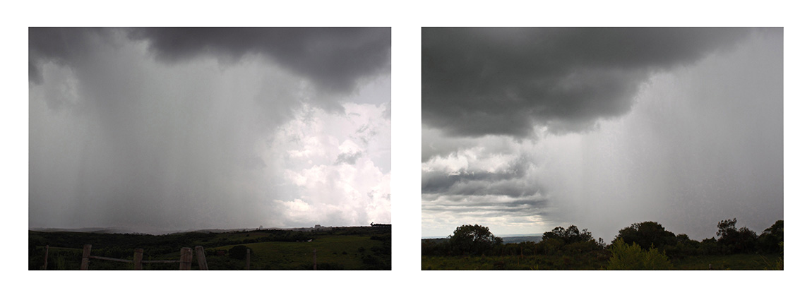
During the trip through the pampas, the perception that political borders seem like a meaningless abstraction was persistent. In contrast, border divisions that coincide with a geographical delimitation give it another meaning: for example, the Uruguay River, which separates Brazil from Uruguay, and the latter from Argentina, as well as the Jaguarão River, which delimits the borders of the extreme south of Brazil.
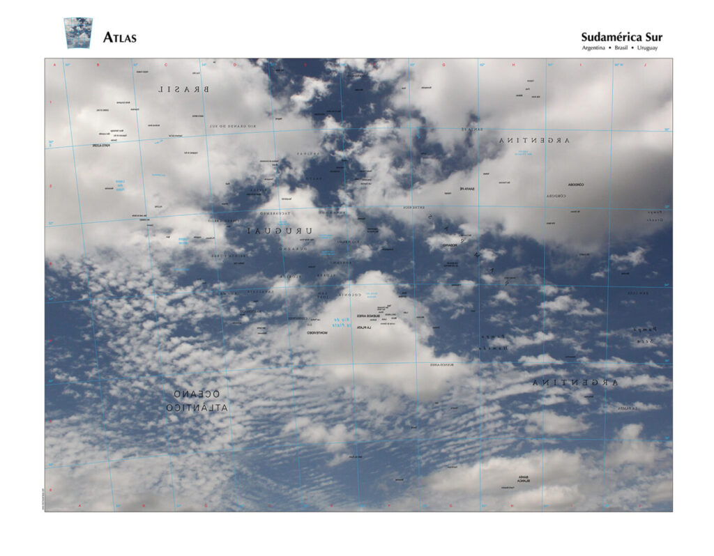
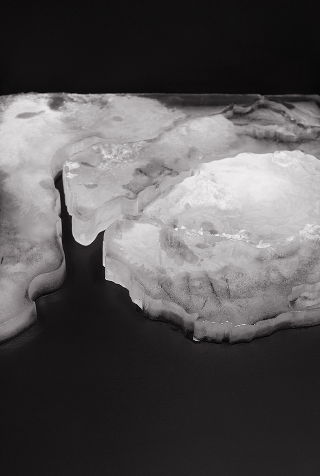
“Geography” is thought from the map of the southern Mercosur region, representing the geographical and border delimitations formed by seas, lakes, or rivers. This region map is reproduced in a block of ice, changing its shape as the ice melts; these boundaries are also lost. Geography unfolds in a video (which is accompanied by the sound work “Landscape with waves” and a series of photographs.
TREATY OF LIMITS:
- Place: Tacuarembó (installation and photograph)
- Geography (landscape with waves) (photographs, video, and sound work)
- Atlas – Sudamérica Sur (offset printing)
- Borders (photographs)