ECLIPSES
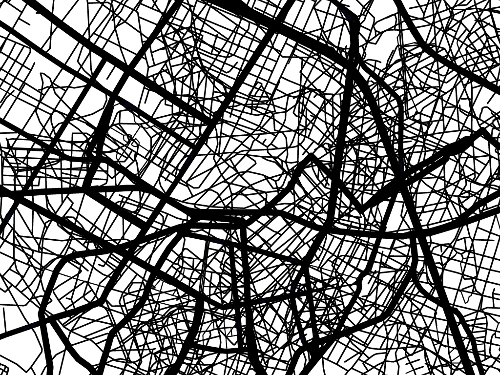
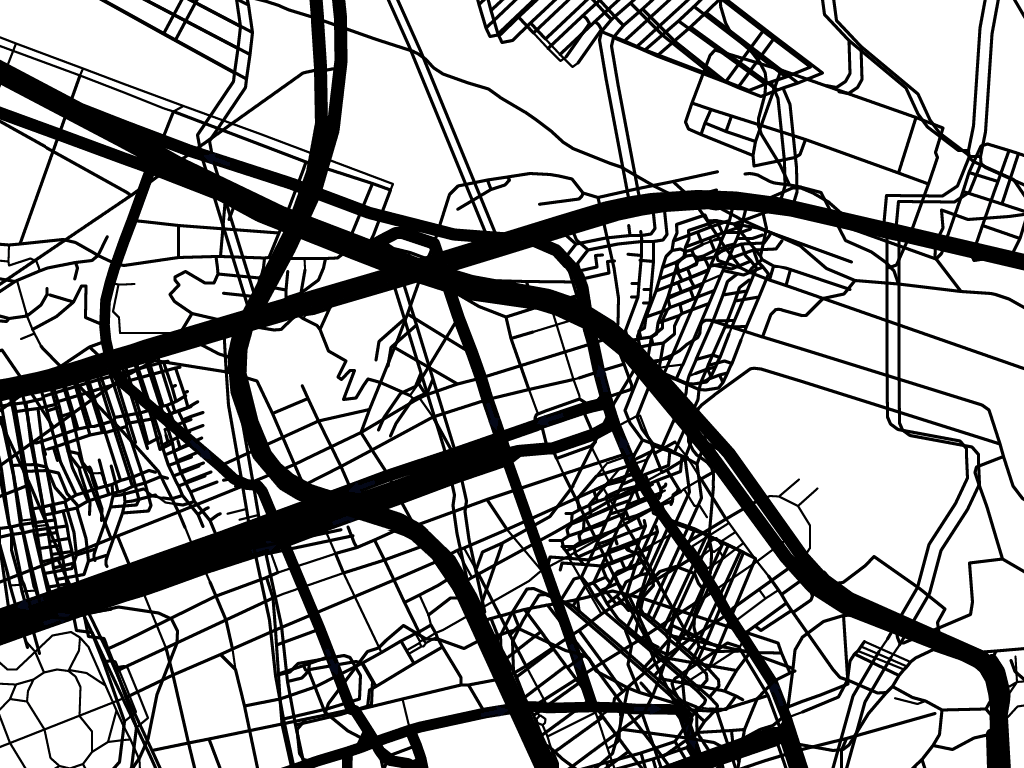
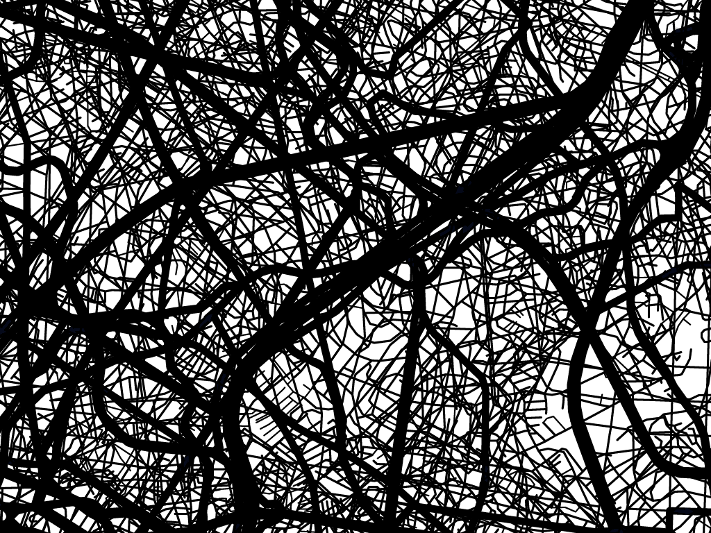
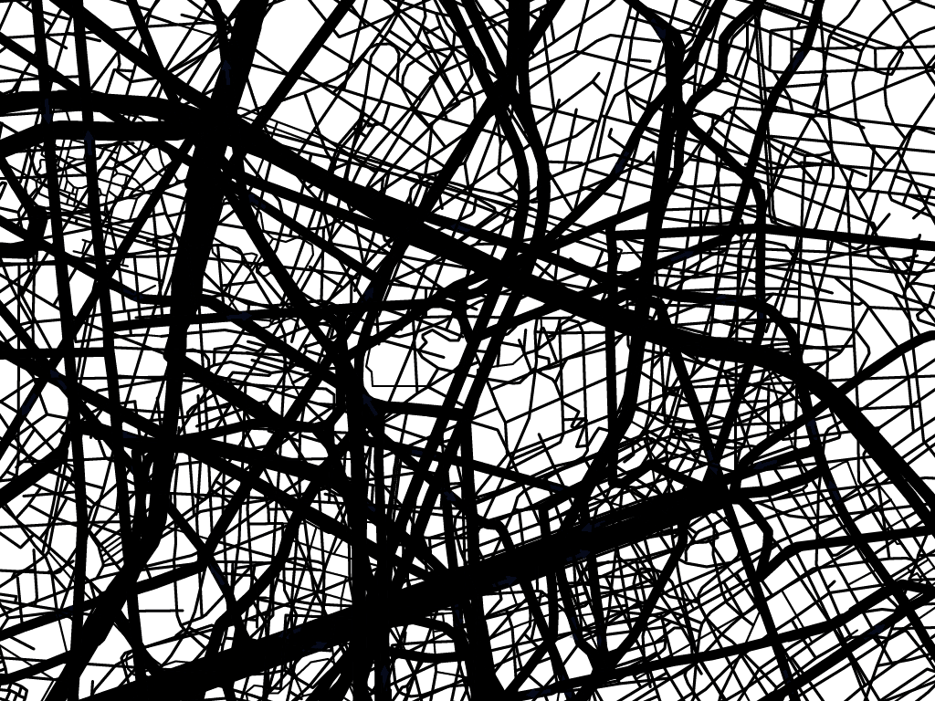
Eclipses is a web artwork that grabs maps from Google Maps and uses them to create images, mixing the plans. It starts with the cities’ names where the work has been shown (Porto Alegre, São Paulo, and Recife). After a town is selected, a list of street names is presented. Then, Eclipses shows each address’s map with the same name in different cities in the country, one after another, centered at that address. After all the plans are shown, Eclipses creates an image mixing all the maps, overlapping all the streets with the same name in different locations.
ECLIPSES
Collaboration between Andrei Thomaz and Marina Camargo
Software that uses Google Maps to generate images that result from the combination of maps collected online.

2007 / 2015 / 2016

Link: eclipses.art.br
- This is the second version of Eclipses. The first one, developed in 2007, was Flash-based and used the Google Maps Flash API, now outdated. The work was rebuilt between 2015 and 2016, this time using the Google Maps JavaScript API. Until now, we made three editions of Eclipses. To create the first one, we listed the streets inside the area occupied by Percursos (Paths) art project, realized in September 2007 in Porto Alegre, Brazil.
- In the second version of Eclipses, we focused on the streets in the surrounding area of Funarte (National Foundation for the Arts) in São Paulo, which presented the exhibition Lugares/Representações (Places/Representations) in 2011. Finally, in the third one, we researched the streets of Recife around Torre Malakoff, an old astronomic observatory where the exhibition A cidade, as ruínas e depois (The city, the ruins and the aftermath) took place in 2016.
- The work begins with the names of three cities where Eclipses have been presented. After a town is picked up, a list of streets of this is presented. The viewer has to choose some street to continue. When a street is chosen, Eclipses shows the map of each street occurrence, one after another. Each map is centered on the street with the name selected by the viewer. After all the plans are shown, Eclipses creates an image generated by the software in real-time.