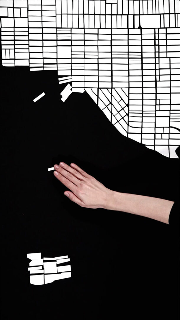
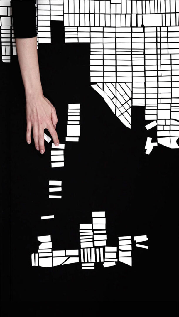
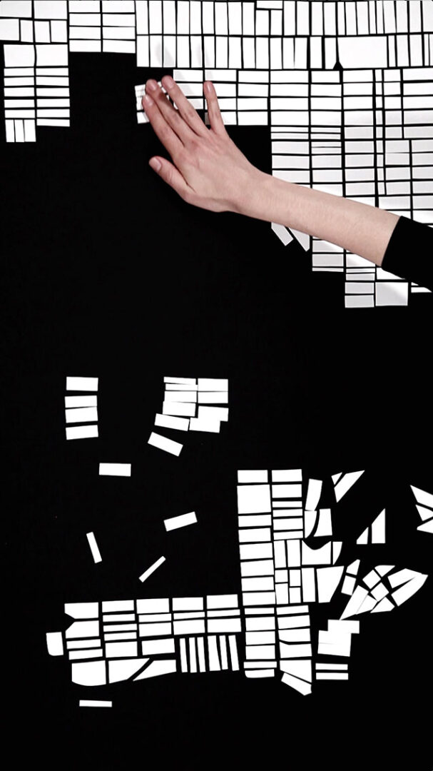
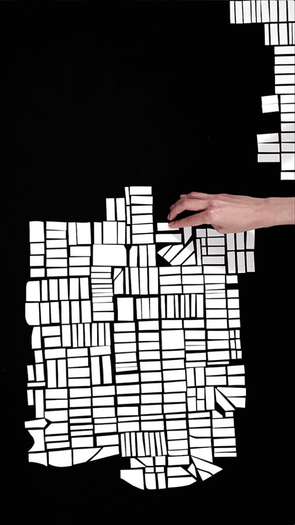
Projected city 4
Projected City is a series of videos in which a region of the urban plan is reproduced and then transformed into another map by moving its parts. The urbanism represented in each edition of Projected City corresponds to the city where the work is shown.
Projected City 4 (Seattle) departs from depicting the neighborhoods of Adams and part of West Woodlands (it was based on the data showing the areas in Seattle where the higher number of household displacements was registered in 2019).
PROJECTED CITY 4 (SEATTLE)
Video
14 minutes
2021